


View In Room
ArtRealSize™

About
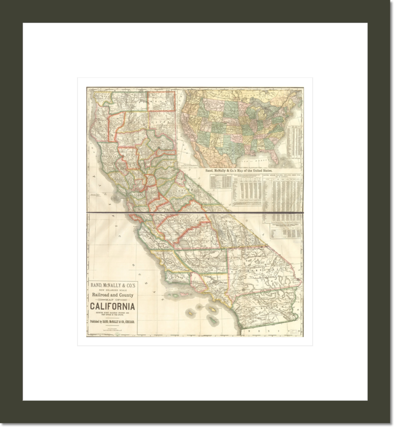
This is a close up map of California in 1883. The map delinates counties,railroads, county roads and cities. The map was made by Rand McNally and Company.
SKU: 64723
Creator: Rand McNally and Company
Date: 1883
Location: Library of Congress
New enlarged scale railroad and county map of California showing every railroad station and post office in the state.
We Offer High Quality
Custom Framing
We use the highest quality wood in our modern shop to create custom frames, frame your print with precision-cut acid-free mat board, and mount it behind a UV-blocking semi-gloss plexiglass to protect your art from the sun, dust, pollution, heat, and humidity. Then we add finishing touches like a wall hanging mount, wall friendly bumpers and a protective backing.
Please note that the images of frames displayed here are meant to be representative of those used in our custom-framed products, but may not exactly match the ones in the actual products.


Testimonials
I was pleasantly surprised when my print arrived. The colors were vibrant and the image crisp and clean. Customer service was very responsive and friendly. I will be placing more orders in the future.
A.R.
I can’t tell you how pleased I was with the quality, accuracy, and clarity. You far exceeded my expectations... so truly mirrors the original pleases me more than I can say.
M.B.
I just received the Alex Coville canvas print. It arrived in perfect condition... Thank you for the excellent work.
I.S.
We are delighted with our prints. They look gorgeous. The frames are very high quality.
L.S.

We Offer High Quality
Custom Framing

We use the highest quality wood in our modern shop to create custom frames, frame your print with precision-cut acid-free mat board, and mount it behind a UV-blocking semi-gloss plexiglass to protect your art from the sun, dust, pollution, heat, and humidity. Then we add finishing touches like wall hanging mount, wall friendly bumpers and a protective backing.