


View In Room
ArtRealSize™

About
SKU: 64725
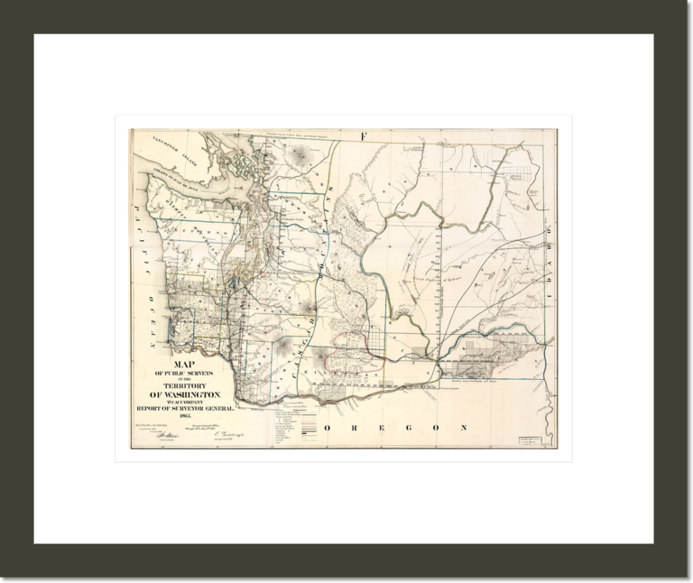
Creator: Joseph S. Wilson
Date: 1865 to 1866
Location: Library of Congress
Map of public surveys in the territory of Washington.
We Offer High Quality
Custom Framing
We use the highest quality wood in our modern shop to create custom frames, frame your print with precision-cut acid-free mat board, and mount it behind a UV-blocking semi-gloss plexiglass to protect your art from the sun, dust, pollution, heat, and humidity. Then we add finishing touches like a wall hanging mount, wall friendly bumpers and a protective backing.
Please note that the images of frames displayed here are meant to be representative of those used in our custom-framed products, but may not exactly match the ones in the actual products.
Testimonials
I was pleasantly surprised when my print arrived. The colors were vibrant and the image crisp and clean. Customer service was very responsive and friendly. I will be placing more orders in the future.
A.R.
I can’t tell you how pleased I was with the quality, accuracy, and clarity. You far exceeded my expectations... so truly mirrors the original pleases me more than I can say.
M.B.
I just received the Alex Coville canvas print. It arrived in perfect condition... Thank you for the excellent work.
I.S.
We are delighted with our prints. They look gorgeous. The frames are very high quality.
L.S.

We Offer High Quality
Custom Framing

We use the highest quality wood in our modern shop to create custom frames, frame your print with precision-cut acid-free mat board, and mount it behind a UV-blocking semi-gloss plexiglass to protect your art from the sun, dust, pollution, heat, and humidity. Then we add finishing touches like wall hanging mount, wall friendly bumpers and a protective backing.